
My husband and I were staying at an Airbnb in Taupō, New Zealand, when our host asked if we planned to hike the Tongariro Alpine Crossing. I admitted I’d never even heard of it, which seemed to surprise her. After all, the Tongariro Alpine Crossing is widely considered one of the best day hikes in the world.
Think sweeping alpine views, shimmering emerald lakes, ancient volcanic craters, windblown tussock-covered hills, and lush native forests, all packed into a 19.4-kilometre trek.
We were sold.
What we didn’t realize was that this wasn’t your average scenic walk. After all, there aren’t too many hikes that I know of that require you to sit through an eight-minute safety video first.
The video highlighted everything from rapidly changing weather conditions to the importance of proper preparation. Because the crossing sits in an active volcanic landscape, conditions can change quickly. Thankfully, we were visiting during the New Zealand summer, one of the most stable times of year to tackle the trek.
Although the trail is free and no reservation is required, the crossing is a one-way trek, so most people book a shuttle from nearby towns such as National Park Village, Whakapapa Village or Taupō.
Our alarm went off at 5:30 a.m. and a short while later we were leaving our peaceful retreat in Lake Taupō behind, on our way to the base of Tongariro.
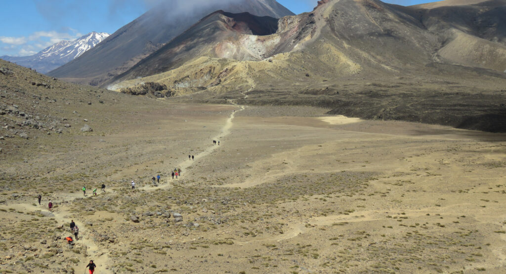
I watched as the landscape began to change slowly, the alpine crossing looming on the horizon. The lush and green rolling hills of Lake Taupō area fell away and a dusty bushland grew up around us.
As we stood at the trailhead to the hike, we were handed a map with a printed guide for our crossing. Each section of the trail was separated into difficulty ratings with a smiley face, a neutral face, and a frowning face. I was less than enthusiastic to know that only about two hours of the hike would be “smiles”.
And most of those smiles would be at the beginning of the hike.
It’s easy to get a false sense of security at the start of the Tongariro Alpine Crossing. As the morning sun climbs higher in the sky, the trail begins gently, with flat terrain, wooden boardwalks and well-maintained gravel paths. Perhaps it should have been an omen that looming ahead of us was Mount Ngauruhoe—better known as Mount Doom in The Lord of the Rings films.
Just as we were easing into the walk, our confidence growing and our enjoyment soaring, we came to Devil’s Staircase. The aptly named section of the trail features approximately two kilometres of sustained uphill climbing. Picture 370 steps and more than 200 metres of elevation gain.
This was the point where we began passing hikers turning back. Some looked exhausted, while others appeared to realize they weren’t prepared for the challenge ahead. Flip flops hardly seem like the right choice of footwear to tackle such a hike.
And I won’t pretend Devil’s Staircase was a walk in the park, because it wasn’t. It was hard. Very hard. But as soon as we reached the top and stepped into the vast expanse of South Crater, surrounded by 360-degree views of rugged mountain ranges and volcanic terrain, the exhaustion seemed to disappear.
The walk across South Crater was easily my favourite part of the day, not least because, after the relentless climb of Devil’s Staircase, it was flat and a welcome reprieve. If it weren’t for the fact that we could see people disappearing into the clouds as they climbed toward Red Crater, I might have thought all the previous warnings were exaggerated.
But of course, 1.5 kilometres passes quickly and before long, we found ourselves traversing over loose rock and steep ledges as we made our attempt at the summit.
Now’s a good time to mention that when we packed for New Zealand, I had no intention of hiking across a mountain range, so the only athletic shoes I packed were my New Balance 680s. If you ever find yourself on the North Island of New Zealand and decide to tackle one of the world’s most spectacular trails, learn from my mistake: bring proper hiking shoes, because my shoes were no match for the soft, dusty scree beneath my feet.
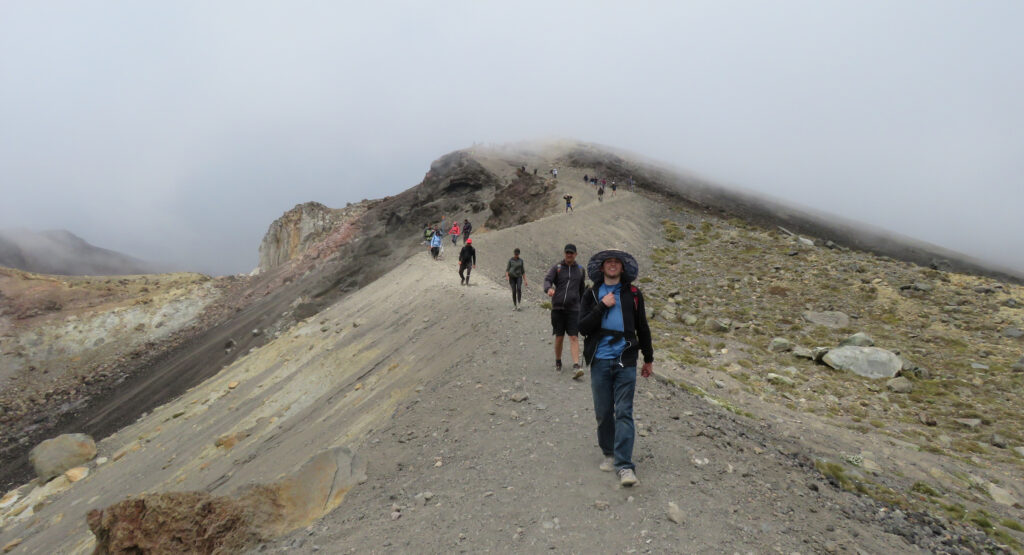
I used my hands as much as my feet to reach the top. And when I did, we sat for a few moments above the clouds, catching brief glimpses of the beautiful blue and green lakes to come and of the part of the trail we’d already conquered.
If I thought the climb to the summit was tough, getting back down was another level. Loose stones made the route to the Emerald Lakes surprisingly tricky. People with hiking poles and proper footwear were struggling, and I had to stop multiple times to empty pebbles from my shoes.
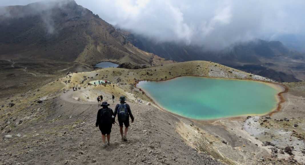
But again, despite the challenge, we were rewarded with views you only ever see on postcards and computer backgrounds. Three emerald-coloured lakes stretched out below us, their vivid waters contrasted against the orange and red hues of the surrounding volcanic landscape.
The lakes get their striking colours from minerals in the surrounding volcanic rocks and geothermal activity beneath the surface. However, unlike other geothermal pools in the area, these lakes are cold. Even if you feel the urge to take a post-summit dip, you’ll want to resist—the pools are considered sacred by the Māori people of New Zealand, and touching the water is viewed as disrespectful.
We braked for lunch near to the lakes, although we were sure not to sit too long as our muscles were already starting to tighten. With more than two hours and approximately six kilometres left to tackle, we couldn’t afford to give in now.
So, our descent began.
It was amazing how quickly I began to yearn for the uphill sections of earlier in the day because it didn’t take long for my knees to begin to ache. The continuous downhill movement put pressure on my toes as they continuously slammed into the front of my shoes. A barefoot runner passed us, and although I felt a slight judgment about his choice in footwear, I realized that at least he’d still have toes intact by the end of the day.
It wasn’t just the pressure on my joints that made the last stretch of the walk a challenge, it was the mental factor too. At this point, we could see the end of the trail in the distance. The people far off in front of us looked like ants, which meant we still had a big distance to cover.
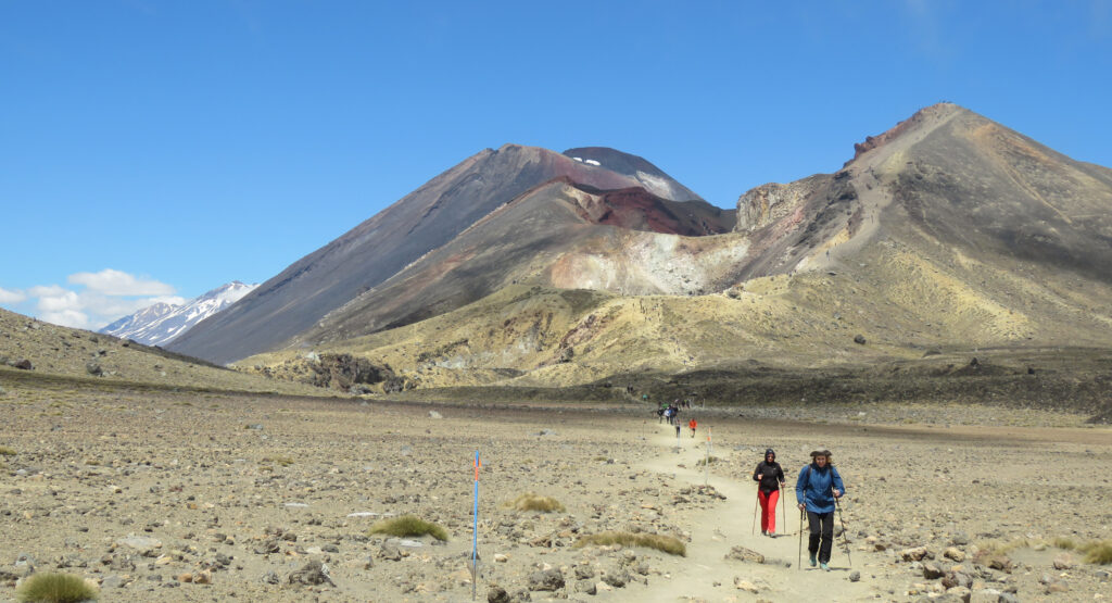
We descended into the trees, lush and tropical plants spread out around us. The warm, humid air of the New Zealand summer had returned and the wind had all but died off. It was so bizarre to be in such a green and thriving forest after spending the last four and a half hours passing through extremely desolate landscape where even the strongest plants couldn’t survive.
At the start of the day, I found it almost impossible to picture the finish line—to imagine what it would be like to cross the 19th kilometre. But when we did hit the last kilometre marker and we knew it was only another 400 metres before we reached the end, a fresh burst of energy came over us both.
The burst of energy was powerful enough that as soon as we hit that marker, we took off running.
We could hear voices in the distance and the low murmur of engines. Our feet were blistered, our lungs on fire, our legs numb and our clothes soaked with sweat and dust, but with one stride after another, we closed in on the end.
6.5 hours, 30,000+ steps, 315 flights of stairs, 19.4 kilometres.
The Tongariro Alpine Crossing: challenging, humbling and incredibly rewarding.
Eventually, I regained feeling in my legs and my toes stopped aching. With the pain and exhaustion behind us, we were left only with memories of the wild views, dramatic landscapes and the pride that comes from tackling one of Earth’s most rewarding trails.
| Tips and good to know |
|---|
Book your shuttle in advance. The crossing is a one-way hike, so most visitors arrange transportation from nearby towns such as Taupō, National Park Village or Whakapapa Village. Parking at the trailhead is limited, making a shuttle the easiest option. Check the weather before you leave. Just because it’s nice in town or at the trailhead doesn’t mean it’s going to be nice when you reach the summit. High winds, rain, snow and low visibility are all possible on the crossing. Wear proper footwear. This is not a casual walking trail. Sturdy hiking shoes or boots with good grip are strongly recommended, especially for the steep scree descent from Red Crater. Better yet, also bring a set of hiking poles. Pack layers. Even in summer, crossing South Crater and climbing Red Crater can be cold and windy. Bring layers and rain protection. Bring enough food and water. Once you get on the trail, there’s nowhere to resupply. Ensure you have enough food and water for a full day on the trail. Know that there are toilet stops along the way, but these can be limited |
You may also like: Travel Stories

Read This Story in Our 2026 Summer & Outdoor Issue
Canada’s best source of health & fitness information — IMPACT Magazine’s 2026 Summer Outdoor Travel Issue: trail running, outdoor travel, workouts and seasonal recipes.
Featuring world-class French-Canadian ultra-trail runner Mathieu Blanchard, this digital edition takes you coast to coast through Canada’s most unforgettable bucket-list hikes, trail-running tips, and race-day strategies. Build strength and balance with targeted summer workouts, master the taper, and find your footing on technical terrain. Plus enjoy seasonal grilling and plant-forward recipes — Grilled Mexican Corn, Hoisin Portobello Burgers with Chili Lemon Broccolini, Smoky Black Bean Quinoa Burgers — and more outdoor cooking inspiration for active travelers.